
Immediately
upon opening the book, readers of Sherwood Anderson’s Winesburg, Ohio are greeted
by a hand-drawn map of the fictional town that is the novel’s setting:
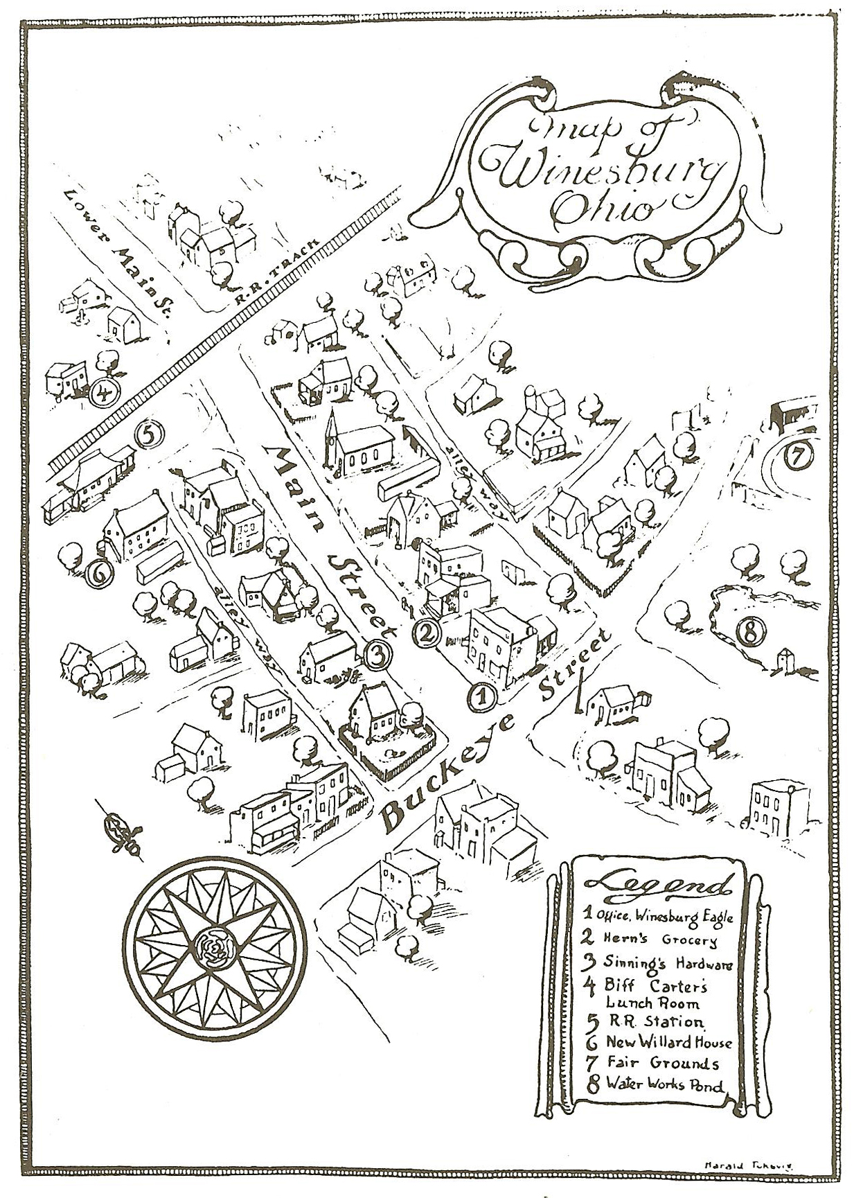
Turns
out Winesburg was a thinly veiled representation of Anderson’s own hometown of Clyde,
Ohio which, like its fictional counterpart, has a Main Street that crosses Buckeye
Street and some railroad tracks a little further north. If you’ve read this post
or this post, you know where I’m going with this. Here is what Clyde, OH looks
like today:
The
distances in the map of Winesburg are deceptively short (a half dozen
structures fill the stretch between Buckeye and the Train tracks, a span that
reaches a 1000 feet in the real world) and there’s not much in terms of
landmarks that would jump out and link the two maps. Not even the train station
or fairgrounds remain. But you can zoom all the way in and use Google’s Street
View to at least stroll along Main and see some of the older buildings that might have stood in Anderson’s time (Not likely,
since he lived there from 1884-1896, but still worth a glance.)